Every station at a glance
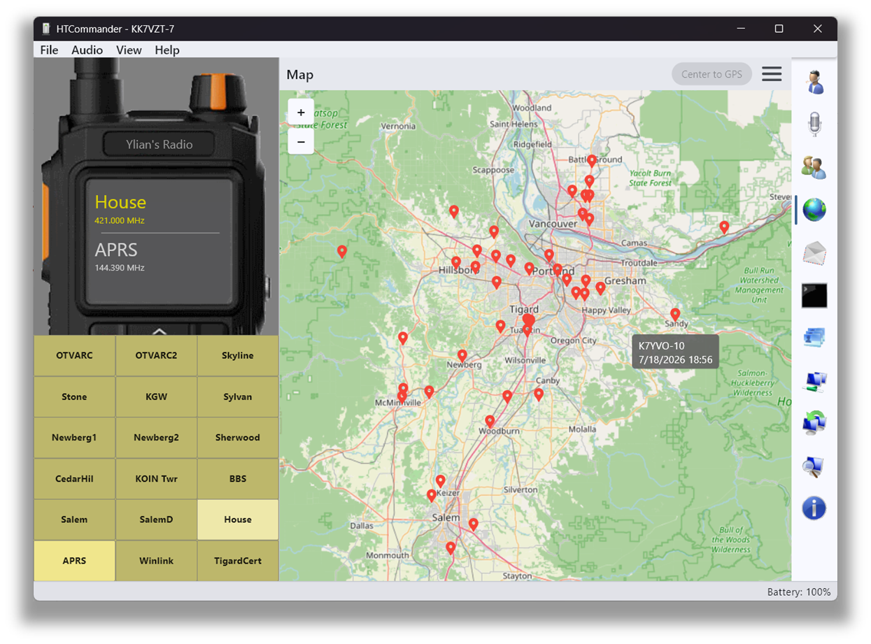
HTCommander has built-in support for OpenStreetMap and plots stations sending APRS telemetry directly on the map. You'll need internet access to load the map tiles. Zoom in and out, pan around, and click a station to see its callsign and details.
Cache areas for offline use
Right-click and drag to select an area of the map, then use the map menu to cache that area to disk. Once cached, you can switch the map into offline mode — no further requests are made to the OpenStreetMap servers. That's ideal for using the map without a connection, for example when you're out in the field.
Private by design
HTCommander does not access the internet at all except to load OpenStreetMap tiles. There is no hidden telemetry. This is in deliberate contrast to the official application for these radios, which sends usage data back to China.
Mini-maps from the APRS tab
In the APRS tab, you can right-click on any station that sent coordinates and choose to see its location on a mini-map — a quick way to place a station without switching tabs.
Available on all platforms: Windows, macOS, Linux, iOS, Android and web. Map data provided by openstreetmap.org.